
Fil:Bayou La Batre harbor aerial view.jpg

Størrelse af denne forhåndsvisning: 800 × 533 pixels. Andre opløsninger: 320 × 213 pixels | 640 × 427 pixels | 1.024 × 683 pixels | 1.500 × 1.000 pixels.
Fuld opløsning (1.500 × 1.000 billedpunkter, filstørrelse: 796 KB, MIME-type: image/jpeg)
|
|
Denne fil er fra Wikimedia Commons. Beskrivelsen af filen fra Commons er gengivet nedenfor. |
| Beskrivelse |
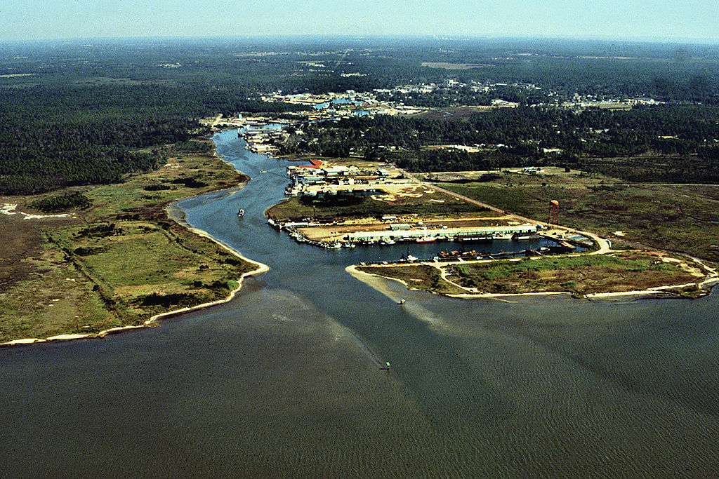
English: Aerial view of the harbor entrance from the Gulf of Mexico at Bayou La Batre, Alabama, USA. View is to the northwest.
Coordinates: 30°23′1.27″N 88°16′16″W / 30.3836861°N 88.27111°W |
|||
| Placering | Bayou La Batre, Alabama, USA | |||
| Dato | (Caveat: Dates provided by U.S. Army Corps of Engineers Digital Visual Library are not reliable and are often wrong.) | |||
| Kilde |
U.S. Army Corps of Engineers Digital Visual Library Image page Image description page Digital Visual Library home page |
|||
| Forfatter | Adrien Lamarre, U.S. Army Corps of Engineers | |||
| Tilladelse (Genbrug af denne fil) |
|
Filhistorik
Klik på en dato/tid for at se filen som den så ud på det tidspunkt.
| Dato/tid | Miniaturebillede | Dimensioner | Bruger | Kommentar | |
|---|---|---|---|---|---|
| nuværende | 28. apr. 2007, 07:06 | | 1.500 × 1.000 (796 KB) | DanMS | {{Information | Description = {{en|Aerial view of the harbor entrance from the Gulf of Mexico at Bayou La Batre, Alabama, USA. View is to the northwest.}} Coordinates: {{Coor dms|30|23|1.27|N|88|16|16|W|type:city|display=inline}} | Source = U.S |
Filanvendelse
Den følgende side bruger denne fil:
Global filanvendelse
Følgende andre wikier anvender denne fil:
- Anvendelser på ar.wikipedia.org
- Anvendelser på arz.wikipedia.org
- Anvendelser på ca.wikipedia.org
- Anvendelser på ceb.wikipedia.org
- Anvendelser på ce.wikipedia.org
- Anvendelser på cy.wikipedia.org
- Anvendelser på de.wikipedia.org
- Anvendelser på de.wikivoyage.org
- Anvendelser på en.wikipedia.org
- Anvendelser på es.wikipedia.org
- Anvendelser på eu.wikipedia.org
- Anvendelser på fr.wikipedia.org
- Anvendelser på ht.wikipedia.org
- Anvendelser på hu.wikipedia.org
- Anvendelser på io.wikipedia.org
- Anvendelser på it.wikipedia.org
- Anvendelser på lld.wikipedia.org
- Anvendelser på no.wikipedia.org
- Anvendelser på pl.wikipedia.org
- Anvendelser på pt.wikipedia.org
- Anvendelser på sh.wikipedia.org
- Anvendelser på sr.wikipedia.org
- Anvendelser på tt.wikipedia.org
- Anvendelser på uk.wikipedia.org
- Anvendelser på uz.wikipedia.org
- Anvendelser på vi.wikipedia.org
- Anvendelser på www.wikidata.org
- Anvendelser på zh-min-nan.wikipedia.org