
Fil:Morocco relief location map.jpg

Størrelse af denne forhåndsvisning: 737 × 600 pixels. Andre opløsninger: 295 × 240 pixels | 590 × 480 pixels | 944 × 768 pixels | 1.223 × 995 pixels.
Fuld opløsning (1.223 × 995 billedpunkter, filstørrelse: 265 KB, MIME-type: image/jpeg)
|
|
Denne fil er fra Wikimedia Commons. Beskrivelsen af filen fra Commons er gengivet nedenfor. |
Beskrivelse
| Beskrivelse |
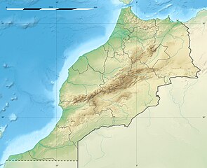
English: Blank physical map of Morocco, for geo-location purposes.
Français : Carte physique vierge du Maroc, destinée à la géolocalisation. Scale: 1:4,000,000 (precision: 1,000 m)
Geographic limits of the map:
|
||
| Dato | 2009-11, updated 2017-02 | ||
| Kilde |
Eget arbejde
|
||
| Forfatter | Eric Gaba (Sting - fr:Sting) | ||
| Tilladelse (Genbrug af denne fil) |
|
||
| Andre versioner |
|

| Kameraposition | | Dette og andre billeder på deres position på: OpenStreetMap |
|---|
Licensering
Jeg, dette værks ophavsretsindehaver, udgiver hermed værket under den følgende licens:
Denne fil er udgivet under Creative Commons Kreditering-Del på samme vilkår 3.0 Ikke-porteret-licensen.
- Du må frit:
- at dele – at kopiere, distribuere og overføre værket
- at remixe – at tilpasse værket
- Under følgende vilkår:
- kreditering – Du skal give passende kreditering, angive et link til licensen, og oplyse om der er foretaget ændringer. Du må gøre det på enhver fornuftig måde, men ikke på en måde der antyder at licensgiveren godkender dig eller din anvendelse.
- deling på samme vilkår – Hvis du bearbejder, ændrer eller bygger videre på dette værk, skal du distribuere dine bidrag under den samme eller en kompatibel licens som originalen.

|
Tilladelse er givet til at kopiere, distribuere og/eller ændre dette dokument under betingelserne i GNU Free Documentation License', Version 1.2 eller enhver senere version udgivet af Free Software Foundation; uden et invariant afsnit, ingen forsidetekster, og ingen bagsidetekst. En kopi af licensen er inkluderet i afsnittet GNU Free Documentation License. |
Du kan vælge den licens du foretrækker.
Filhistorik
Klik på en dato/tid for at se filen som den så ud på det tidspunkt.
| Dato/tid | Miniaturebillede | Dimensioner | Bruger | Kommentar | |
|---|---|---|---|---|---|
| nuværende | 10. feb. 2017, 22:55 | | 1.223 × 995 (265 KB) | Sting | Updated regions borders as since 2015 |
| 19. jul. 2010, 15:11 |  | 1.223 × 995 (234 KB) | Sting | Color profile | |
| 21. nov. 2009, 22:31 |  | 1.223 × 995 (240 KB) | Sting | Putting back the southern dotted boundary (regarding Western Sahara's location map) | |
| 21. nov. 2009, 03:23 |  | 1.223 × 995 (239 KB) | Sting | Drawback for one "correction" | |
| 21. nov. 2009, 03:10 |  | 1.223 × 995 (240 KB) | Sting | Several little corrections | |
| 21. nov. 2009, 02:09 |  | 1.223 × 995 (241 KB) | Sting | == {{int:filedesc}} == {{Location|31|46|30|N|7|04|30|W|scale:5000000}} <br/> {{Information |Description={{en|Blank physical map of Morocco, for geo-location purposes.}} {{fr|Carte physique vierge du Maroc, destinée à la gé |
Filanvendelse
De følgende 17 sider bruger denne fil:
- Al Hoceima Nationalpark
- Antiatlas
- Aït Faska
- Haut Atlas Oriental Nationalpark
- Høje Atlas
- Iriqui Nationalpark
- Jbel Toubkal
- Jordskælvet i Agadir 1960
- Jordskælvet i Marrakesh-Safi 2023
- Khenifiss Nationalpark
- Merja Zerka
- Sous (flod)
- Souss-Massa Nationalpark
- Talassemtane Nationalpark
- Tazekka Nationalpark
- Toubkal Nationalpark
- Skabelon:Kortpositioner Marokko
Global filanvendelse
Følgende andre wikier anvender denne fil:
- Anvendelser på af.wikipedia.org
- Anvendelser på ar.wikipedia.org
- Anvendelser på ast.wikipedia.org
- Anvendelser på azb.wikipedia.org
- Anvendelser på az.wikipedia.org
- Anvendelser på ba.wikipedia.org
- Anvendelser på be.wikipedia.org
- Anvendelser på bg.wikipedia.org
Vis flere globale anvendelser af denne fil.